Wreckhunter.net

Hunting New England Shipwrecks

Beaver Tail

Click on thumbnail image for a larger view
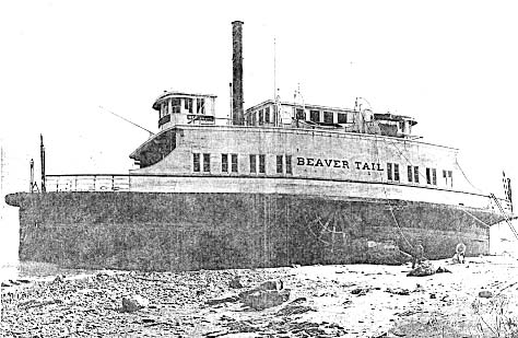
beavertail-msm.JPG (45874 bytes) 

beavertaill-2.jpg (62895 bytes)

Beaver Tail
aground after hurricane
(Mystic Seaport Museum)

Beaver Tail
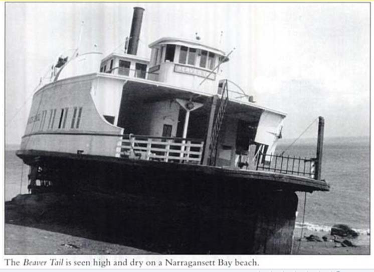
aground - another view
(Author's collection)

The table below provides historical and statistical data on the vessel. Some of the information may be incomplete. If you have additions or corrections, please e-mail us at the address listed below.

Shipwreck Data

Vessel Name Beaver Tail
Other Names  
Vessel Type Passenger Ferry
Owner Jamestown & Newport Ferry Co.
Length / Beam / Draft (feet) 110' / 26' / 11'
Tonnage 301
Hull Construction Wood
Propulsion Steam / Sidewheels
Cargo  
Built 1896 at Wilmington, DE
Date of Loss September 21 , 1938
Reason for Loss Blown ashore in hurricane
Fatalities None
Location Narragansett Bay, RI, northeast side of Conanicut Island, just north of Cranston Cove
Coordinates (Lat/Lon)41 41-32-47N / 71-21-40W
Coordinates (Loran C)  
Water Depth (feet)  
Typical Visibility (feet)  
Wreck Condition Vessel was blown high and dry on beach and extensively salvaged. Probably no wreckage remains.
Diving Considerations  
Other Information  
Attention Divers
The information on this page was obtained from a variety of sources. Although we have attempted to make it as accurate as possible, it may contain errors.  For your personal safety, use extreme caution when diving on this wreck.

For more information on this wreck's location and history, and water and diving conditions in the area, contact local dive shop personnel, dive charter boat operators and local fishermen. Also check out the other shipwreck Websites listed on our Favorite Links page.


To go to other pages on this site, use the Site Navigator at left, or click here to go to our Home Page.

Comments or questions
editor@wreckhunter.net

Copyright © 2001 by Dave Clancy
All Rights Reserved