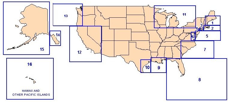
NOAA's AWOIS (Automated Wreck and Obstruction Information System) database is a great and free research tool for wreck hunters. Its contents are quite extensive, and using it is easy. The AWOIS database is available for download to your computer by geographic regions (see regions map below). Downloads are available in PDF (Adobe Acrobat) and MDB (Microsoft Access) formats. Once you download a regional database, you can display it and scroll through the information, or search for a wreck by name or other term. In order to view the information, you will need to have the Adobe Reader or Microsoft Access program installed on your computer.
To go to the AWOIS Website, click the link below. The site contains instructions on how to use the database and links for downloading the files. Good luck with your research!
AWOIS Regions Map
Typical AWOIS data
Vessel Name
Chart #
Area
Cartocode
Depth
Latitude*
Longitude*
History
PINTHIS
13267
A
370
58
42/09/18.36
070/33/46.12
DESCRIPTION 24 NO.244; CARGO; SUNK 6/10/30; POSITION ACCURACY WITHIN 1 MILE; LEAST ì DEPTH 58 FT. REPORTED THROUGH LIGHTHOUSE SERVICE BUREAU, DEPT. OF COMM. 27 NO.528; CARGO, SUNK 6/10/30, LD OF 8 FT AT MLW. 206 ON JUNE 10, 1930 THE STEAMER FAIRFAX RAMMED INTO THE OIL ì TANKER PINTHIS IN A HEAVY FOG; EXPLOSION AND FIRE AFTER THE ì IMPACT RESULTED IN LOSS OF ALL 19 CREWMEMBERS ON THE PINTHIS; ì FAIRFAX LIMPED BACK TO BOSTON; PINTHIS LIES UPSIDEDOWN AT LORAN C ì RATES: 9960-W 13924.4 AND 9960-Y 44175.3. (ENTERED MSM 3/89)
To go to other pages on this site, use the Site Navigator at left, or click here to go to our Home Page.
